
Description of GIS Concept
 Image retrieved from Saylor Academy GIS layers
Most modern maps are created by combining multiple map layers stored in Geographic Information Systems (GIS). Many view a geographic information system (GIS) map as a single canvas. However, it is not the case. GIS runs in layers of features. Each map layer represents a distinct collection of geo-referenced data points that are superimposed on top of the other to form a composite map image. Layers are in the form of Points, Polylines, or Polygons. Each layer has different information. For example, one layer shows the distribution of road networks and their hierarchy. This layer is represented in polylines. Another may show places of interest. This layer will show features in points. A good example of polygons is land use. Polygons can represent commercial areas.
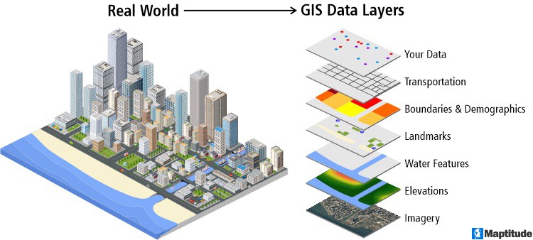 Image retrieved from Caliper.com
Layers ease users to modify information if any amendment is to be made constantly. Users can change the layer properties easily. Colours, symbols, and sizes are among the common properties users might want to manipulate.
This video explains how layers are manipulated to yield interesting information.
This is an additional video, hosted on YouTube.
Geographic Information Systems (GIS) in the Built Environment


Geographic Information Systems (GIS) in the Built Environment
Reach your personal and professional goals
Unlock access to hundreds of expert online courses and degrees from top universities and educators to gain accredited qualifications and professional CV-building certificates.
Join over 18 million learners to launch, switch or build upon your career, all at your own pace, across a wide range of topic areas.


