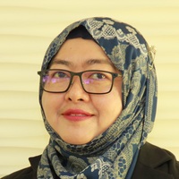
Rosilawati Zainol

Rosilawati Zainol is an Associate Professor at the Department of Urban and Regional Planning, Faculty of Built Environment, Universiti Malaya. Her background is in Urban Analytics and GIS.
Location Malaysia
Activity
-
Hi, non-earth is like you create a layer without determining any projection. It looks good on the map canvas, but it is on the fly and only carries xy coordinates.
If you try to open it in another project with projection, it would not appear.
-
Rosilawati Zainol replied to Elizabeth Cardosa
You can use any type of computer system. A laptop is also good.
-
Rosilawati Zainol replied to Mohmmed Zain
Probably you want to try QGIS as an alternative.
-
Rosilawati Zainol replied to Ahmed Hassan
Very good! Have you tried to build one?
-
Yes, that is very true. You can have an extensive database with all the information you need. However, you only display some of them to give you information that you'd like to share.
-
You need to go to Esri ArcGIS Pro website. Have you signed up as a member with Esri? And have you purchased the software? Have you viewed their website?
-
That is very interesting indeed!
You can make inferences on the cow rearing area and the suitable climate the areas have. You can also link with man power and technology used in these areas.
-
Rosilawati Zainol replied to Luis Gonçalves
That is good to hear. Yes, GIS can do a lot of exciting stuff. Do you have the basic knowledge in GIS?
-
Rosilawati Zainol replied to Ali Salehi
That is very interesting. Glad to hear that you would like to learn more. May I know what you have learned? I mean, the topic that you have covered?
-
Rosilawati Zainol replied to Nyambati Cherono
That is very good. What is your research area if you don't mind sharing?
