Skip main navigation

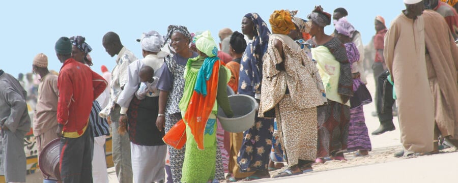
Filling in data gaps in informal settlements

Watch Vitor Pessoa Colombo describe Participatory Geographic Information Systems and their importance for gathering data on informal settlements.
9.2
In order to address urban health inequities, planners need updated and high-quality data on all parts of a city. However, this often doesn’t exist, notably in informal settlements. This lack of data exacerbates the marginalisation of the urban poor, who end up being invisible to local administrations. In order to tackle this issue, Participatory Geographic Information Systems, also known as PGIS, have become increasingly common thanks to the remarkable proliferation of geospatial technologies and Internet connections. Let’s look at some PGIS tools and purposes in urban planning. PGIS are, essentially, bottom-up initiatives to produce geographic information that fills in important data and knowledge gaps. We find a remarkable example of PGIS activity in Nairobi, promoted by the NGO ‘Map Kibera’.
69.3
With the support of local inhabitants, the organisation mapped Kibera, one of the world’s biggest slums. Before this initiative, official maps barely included any spatial features of Kibera. They depicted an empty area, which hardly corresponded to the reality on the ground. Like other PGIS initiatives, ‘Map Kibera’ shares their data on the open-access portal OpenStreetMap. Indeed, OpenStreetMap is a widely used collaborative mapping platform. Anyone can contribute by adding features to the map. This is usually done through events commonly called “Mapathons”, which are organised by various entities, most often NGOs. During these events, volunteers are guided on how to map specific features like buildings or roads. This diagramme from the Humanitarian OpenStreetMap portal illustrates how collaborative mapping can take place.
130.7
The mapping activities can be done remotely, using satellite imagery provided by the activity organiser. The mapping can also be done on-site, using the geo-positioning system of the volunteer’s smartphone or tablet. This is very useful to validate the data that is generated remotely. OpenStreetMap has its own app that allows for on-site data collection. Once the data is uploaded to OpenStreetMap, anyone can download it and use it for all kinds of projects, notably humanitarian action in vulnerable settlements. The only limitation is that the mapping and data upload processes require at least several computers and smartphones connected to the Internet. Also, they require at least basic knowledge in Geographic Information Systems, or guidance by more experienced users.
185.2
Besides the platforms proposed by OpenStreetMap, there are several freely available software solutions that can be used in PGIS activities. For instance, Google Earth is a virtual globe that allows users to easily digitise geographic information based on satellite imagery. However, unlike OpenStreetMap, it is not open-source. Other software options are also available. Most of them require at least basic knowledge on geographic information, but you can easily find tutorials online. When producing, sharing and publishing data of any kind, it is crucial to comply with standards of individual data protection. You must ensure anonymity and avoid any potential harm to those living in the observed areas.
234.3
Consider carefully where and how data is stored: once it is on the web, assume that it is publicly accessible. Finally, one of the key aspects of PGIS is the actual participation of those living in the observed areas when producing geographic information. Such collaboration is very important to the quality and potential impact of the data produced. In the mid 2000s, geographer Michael Goodchild coined the term Volunteered Geographic Information, also known as “VGI”, while talking about “citizens as sensors”. In the context of African cities, and in the Global South in general, mobile communication devices often have a higher penetration in society than basic services.
283.2
This means that citizens could use technology to give visibility – and hence political leverage – to marginalised communities. Both the quality and quantity of data on vulnerable human settlements could be enhanced thanks to bottom-up, participatory mapping activities. Geospatial technologies that are now highly accessible can support this. In this regard, PGIS offers a great potential to develop more efficient, targeted and inclusive interventions by giving voice to communities that often remain invisible to local administrations.
In this video, Vitor Pessoa Colombo describes Participatory Geographic Information Systems and their importance for gathering geographic data on informal settlements.

Geographic information is critical for urban planning. Updated and high-quality data on all parts of a city helps planners address urban health inequities. Planners can then make decisions on an intra-urban level in order to reach targeted population groups, assess social and environmental impacts, and optimise resources. However, such information is very often missing or incomplete in the case of informal settlements.

Vitor Pessoa Colombo introduces Participatory Geographic Information Systems (PGIS) that can be employed to fill in the critical data and knowledge gaps regarding informal settlements. This in turn helps communities which often remain invisible to local administrations, as it gives them a voice and allows for more inclusive urban planning.

This article is from the free online

Examining African Contributions to Global Health

Created by
FutureLearn - Learning For Life

Reach your personal and professional goals

Unlock access to hundreds of expert online courses and degrees from top universities and educators to gain accredited qualifications and professional CV-building certificates.

Join over 18 million learners to launch, switch or build upon your career, all at your own pace, across a wide range of topic areas.

Start Learning now