
Clouds and rain
The animation above, provided by the Met Office, shows a progression of waves on the polar front (where the yellow/green tropical air meets the blue polar air) over the course of a few days. You can see wave after wave growing and breaking.
In Step 1.7 you explored why we get depressions and how they move warm air polewards. Now let’s break the wave’s lifecycle down so we can explore the weather that develops.
In the four stages in Figure 1, the grey shading shows the region of continuous cloud cover. The red warm front and blue cold front denote the boundaries of the central wave of warm air – often called the warm sector. The occluded front (purple) occurs when the wave breaks, and the cold front catches up with the warm front.
Cold fronts are marked with triangles (reminiscent of icicles) and warm fronts with semi-circles (reminiscent of the warm sun).
Figure 1: Four stages in the lifecycle of a depression
Before we go into further detail, let’s take a step back and think about some basic physics. The first thing to remember is that warm air rises, and that warm air rising is called convection.As the warm air rises, there is less atmosphere left above it and so the pressure falls. The first law of thermodynamics tells us that as the air expands, it does work pushing the surrounding air out of the way, and this reduces its temperature. As the rising air cools, the rate of evaporation becomes less than the rate of condensation until eventually cloud droplets form. As water vapour condenses into liquid water, latent heat is released providing the energy source for the developing storm. And the latent heat generated is significant. For example, there is enough heat released in a small cumulus cloud to power an average home for 17 years. As the storm continues to develop, some of the cloud droplets will become large enough to fall as rain.Figure 2: Cumulus clouds are indicative of convection. You can sometimes watch them billowing upwards as the air rises within them. ©RMetS
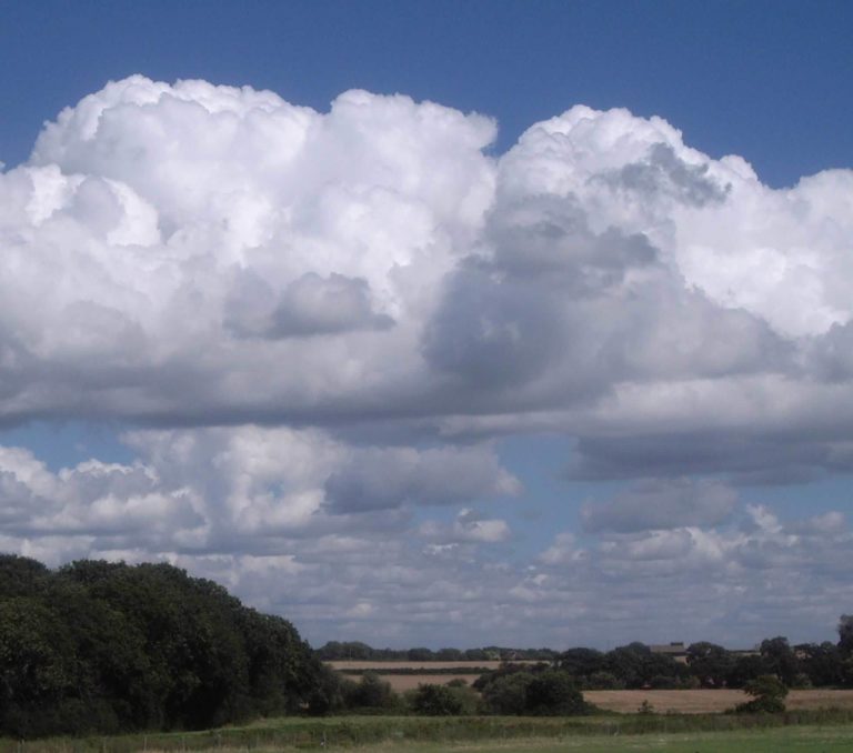
Figure 3: A cross section through a depression at stage 2 © Dr Peter Inness
Come Rain or Shine: Understanding the Weather


Come Rain or Shine: Understanding the Weather
Reach your personal and professional goals
Unlock access to hundreds of expert online courses and degrees from top universities and educators to gain accredited qualifications and professional CV-building certificates.
Join over 18 million learners to launch, switch or build upon your career, all at your own pace, across a wide range of topic areas.


