
Guided reading: open-access data and metadata
This short guided reading builds on the video by looking at the practical side of open-access data: the portals where you find it, and the metadata you should always check before you use it. As you read, pause at the interpretation questions and try to answer them before moving on – they’re there to help you check your understanding, not to be submitted.
Open-access atmospheric data workflows
Operational oceanography increasingly depends on open-access environmental datasets and online data portals.
These systems allow users to:
- access atmospheric products,
- explore environmental datasets,
- and download forcing variables used in forecasting applications.
Examples of widely used open-access atmospheric data systems include the Copernicus Climate Data Store (CDS), ECMWF portals, NOAA NOMADS, and EUMETSAT services. These platforms provide reanalysis datasets, operational forecasts, climate records, and environmental forcing products.
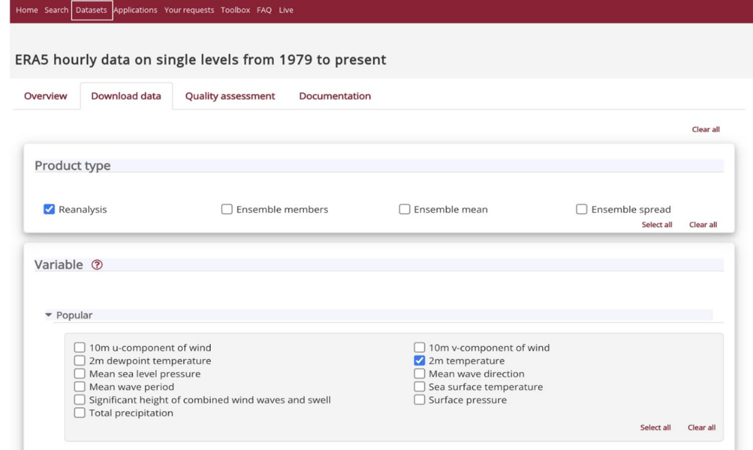
Figure 1. Example of an open-access atmospheric data portal.
Guided interpretation questions
- Which variables are available through atmospheric data portals?
- Why is ERA5 widely used in operational oceanography?
- Why are open-access systems important for education and forecasting capacity development?
Interpretation example: Open-access environmental data systems reduce barriers to participation in operational oceanography by providing freely accessible atmospheric and environmental datasets to users around the world.
Environmental dataset metadata
Metadata provide important information about environmental datasets, including their variables, units, coordinates, resolution, temporal coverage, and update frequency.
You should always examine metadata before downloading or using an environmental dataset.
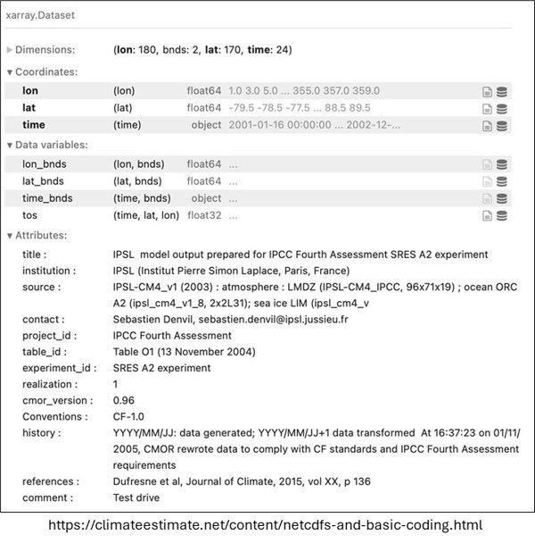
Figure 2. Example of climate dataset metadata.
Guided interpretation questions
- Why is metadata important?
- What problems may occur if units are misunderstood?
- Why does spatial resolution matter?
- Why is update frequency important for operational forecasting?
Interpretation example: Two datasets may both provide sea surface temperature, but differ greatly in spatial resolution, temporal frequency, or update schedule. Operational users must therefore understand dataset characteristics before selecting products for forecasting applications.
Key takeaways
- Operational ocean forecasting systems depend on upstream atmospheric and oceanic datasets
- Atmospheric forcing strongly influences ocean circulation and forecast evolution
- Satellite and in-situ observations provide complementary information
- Argo floats provide critical subsurface ocean observations
- Open-access environmental datasets improve forecasting accessibility and capacity development
- Metadata interpretation is essential before using environmental datasets
- Data quality and availability strongly influence forecast reliability







