Skip main navigation

New offer! Get 30% off one whole year of Unlimited learning. Subscribe for just £249.99 £174.99. New subscribers only. T&Cs apply

Find out more

UK Air Masses

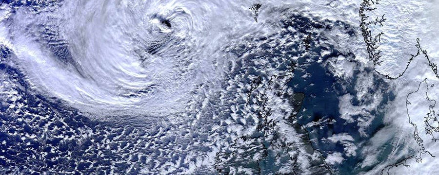
Let’s think about the properties and characteristics of the air reaching the UK. Let’s start with the concept of air masses and consider the properties of the air that will impact the weather.
Air Masses Introduction
© PublicDomainPictures, Pixabay

Let’s think about the properties and characteristics of the air reaching the UK.

Let’s start with the concept of air masses and consider the properties of the air that will impact the weather.

What is an Air Mass?

An air mass is a large body of air with relatively uniform characteristics (temperature and humidity). Air masses are classified according to their source region and track.

The 6 UK Air Masses

There are six air masses (Figure 1) which can affect the weather in the UK – Polar Maritime is the most common, but we can also experience Polar Continental, Tropical Maritime, Tropical Continental, Arctic Maritime and Returning Polar Maritime air.

The source regions tend to be semi-permanent anticyclones (associated with the sinking regions of the global atmospheric circulation) in the sub-tropics and polar regions (‘tropical’ or ‘polar’ air). Air masses acquire their characteristics by contact with the underlying surface in the source region.

The UK sometimes also gets Arctic air, which has travelled straight south from the Arctic. Returning polar air is polar air which changed direction over the Atlantic, hitting the UK from the west or even southwest, but still polar in nature.

Figure 1: The 6 air masses which can affect the weather in the UK

Southward moving air is warmed from below as it passes over warmer land and water and becomes more unstable, eventually rising and producing convective cloud – eg puffy cumulus clouds. When you look at these clouds you can sometimes watch the air rising and the cloud bubbling up. In contrast, northward flowing air is cooled from below and becomes more stable.

Air travelling over the sea is moistened and we refer to this as ‘maritime’ air, whereas the moisture in air with a continental track hardly changes and so this is known as ‘continental’ air.

Looking at Figure 1, it’s easy to think that the North East of the UK always experiences Polar Continental air, whilst the South West always experiences Tropical Maritime air etc, but this is not the case. Usually, the whole country experiences the same air mass at the same time. A front is where two air masses meet.

Air Masses and the UK Weather

You may like to watch the following clip from the BBC programme, The Great British Weather, on YouTube, to find out more and for a great introduction to air masses.

© University of Reading and Royal Meteorological Society
This article is from the free online

Come Rain or Shine: Understanding the Weather
Created by
FutureLearn - Learning For Life

Reach your personal and professional goals

Unlock access to hundreds of expert online courses and degrees from top universities and educators to gain accredited qualifications and professional CV-building certificates.

Join over 18 million learners to launch, switch or build upon your career, all at your own pace, across a wide range of topic areas.

Start Learning now