Skip main navigation

New offer! Get 30% off your first 2 months of Unlimited Monthly. Start your subscription for just £35.99 £24.99. New subscribers only T&Cs apply

Find out more

Maps and the politics of the archive

Maps and the Politics of the Archive
Maiken Umbach
Hayley Cotterill
9
Welcome back. This week, as we’re thinking about space and how it relates to belonging, we’ve been thinking about maps. We’ve been looking at maps at the British Library as a technology for representing space. Maps we’ve seen can help individuals, communities, entire states and empires stake out claims to land, transforming land into political territory. So when we make sense of maps as ideological objects, we need to ask not only what they look like, but also who decides whether a map’s made in the first pace, and also equally importantly, who decides whether or not a map is kept, preserved, or discarded.
45.3
To discuss this question, I’m joined today by Hayley Cotterill, who’s the assistant archivist at the Special Collections of the University of Nottingham. So Hayley, welcome. Thank you. Could you begin perhaps by telling us a little bit about the nature of this archive that you work in? Absolutely. Manuscripts and Special Collections Department is responsible for looking after the university’s collections of unique manuscript material and rare published works. These collections include about 3 1/2 million archival documents and over 60,000 published books. The documents range from the mid-12th century right up to the present day, and the collections that we have come to us in a variety of ways.
80.1
A small amount is generated by the university, and we also purchase a small amount. But the vast majority of our collections have been given or loaned to us by people who are aware of the importance of what they have. They want to ensure that it survives, and they want it to be available for research. So how do maps come into this story? Why do you collect them? How do they get to you? Well, maps can be found in lots of our collections, including political and diplomatic papers, the papers of landed families, and business archives. And the survival of historic maps tells us a lot about why they were created and used.
109.8
Because if a document is hundreds of years old, then in certain points in that document’s history, people have had to make choices that have led to its survival. You were just talking about the reasons why maps were made. The reason why a map is then retained is because it has value for its owner, and that value might be monetary, it might be evidential, emotional, or historical. It can stabilise claims of ownership, establish ancestry, or preserve important memories. A map’s evidential value is important, as well, when we are considering its provenance. Because if you don’t know who created a map or when it was created, then how can you trust the information that it contains?
142.5
The next stage in a map’s survival is when it is offered to an archive. Lots of material will be destroyed without ever being offered to an archive– accidentally because it’s perceived as worthless, or as a deliberate attempt at concealment. And this is where the phrase “history is written by the victors” comes to mind. So Hayley, you’ve selected three maps for us to look at in particular. Could you tell us a little bit about what these maps tell us and how we know about why they’re made and why they came to be preserved and stored in this archive here? The first map that I’ve got out is an example of an enclosure map.
172.4
So this map is sewn into the accompanying enclosure wood. And that lists the owners of the newly enclosed landscape with the location and acreage of the plots that they received. Enclosure was a process where large fields or commons were converted into individual private plots of land. So a large field or fields would be split into individual plots, and those plots would be fenced. Enclosure also included the extinguishment of commons rights, such as the right to graze livestock on common land. This is an enclosure map for the parish of North Muskham in Nottinghamshire, which was enclosed in 1771. The large land owners would have agreed among themselves who was going to receive which plot of land in the newly enclosed fields.
211.2
An enclosure map is drawn up as a tool to demonstrate this new ownership of land, so anyone looking at the map can see who has been allocated which plot of land and where exactly that land is. Enclosure maps demonstrate the power of the people behind enclosure, and they would’ve been intended to be kept in the long term. The second example that I have was created for a very different reason. It represents Sichuan Province in China, and is taken from Martino Martini’s Atlas of China, which was published in 1655. Martini was an Italian Jesuit who arrived in the country in 1642. We know that he travelled extensively in China.
247.6
His atlas includes copies of maps of 15 provinces, and we know that he personally visited 7 of them. The cartography, however, is based on European visions of Ming’s surveys. Now, this is a really beautiful, elaborate map, and the reason for its creation is twofold. First of all, it’s informative. So you can see that it shows the mountains, rivers, mines, and major cities and towns of the province. It’s also decorative. It’s there to create an exotic image of China for a European audience, most of whom wouldn’t ever have visited the country. And it has embellishments such as the cartoon showing the Chinese warriors. Now, Martini wasn’t only creating his atlas as an aid to an exploration of China.
284.6
He had a commercial aim, as well. His atlas, which was called the Atlas Sinensis, was the first European atlas of China, and it remained the standard geographic work on that country for almost 100 years. And this, of course, has all helped to aid its survival. Copies of his atlas can be found in libraries and archives all over the world. And the maps that we have were removed from the volume at some point in the past and framed before they came into our possession. The final example that I have is a British Army trench map from the First World War. When the British Expeditionary Force first went to war in France and Belgium, they relied on existing maps.
317.4
But as the war changed from one of movement to one of attrition, they needed new large-scale maps that showed the position on the ground for the troops. So it showed the enemy defensive positions and an accurate portrayal of the land that was being held by the enemy. On this map, the British trenches are marked in blue and the enemy trenches are in red. The position of the British lines is only approximate and narrowly sketched in. A British trench map wasn’t there to help British soldiers find their way around their own trench system.
345.4
Any maps which did accurately show the British lines were classified as secret, and they weren’t supposed to be taken onto the front line in case it fell into enemy hands. This is a map that belonged to a junior officer in the First World War, Vince, and it was never intended to be kept in the long term. Trench maps were constantly being revised and updated as the position on the ground changed so that people had accurate, up-to-date information. And you can see on this map that the position of the trench lines is given as corrected to the 1st of April, 1917. Many of the place names on the map are in English.
375.4
This is because British troops would rename the areas around them, giving them names connected to back home or to their own regiment to help familiarise that area. And some of the names that we can see here include Gatwick Cottage, Kempton Park, and Kitchener’s Wood. So they’re three completely different kinds of maps, some very much designed to be preserved in an official archive, and the last one obviously designed precisely not to be kept in this way. But beyond these differences, is there anything you think that they all have in common that unites them– a common thread that runs through them? Maps fix a moment in time.
407.8
In this way, all maps are historic documents regardless of how modern they might be because they are representations of a particular place at a particular point in time. They stabilise notions of ownership and political projects. But having said that, some maps did evolve over time. People reused them. They annotated and amended them rather than creating a new map every time something changed. And those annotations can tell us a lot about how a map was used, whilst a beautiful, unmarked map was as much about demonstrating power and status as it was providing information. Thank you very much, Hayley. Very interesting.
440.6
I think this takes us very nicely into the next discussion, where we’re going to be thinking about artefacts such as maps and how they frame and shape the way in which we imagine ourselves in relation to land, in relation to territory.

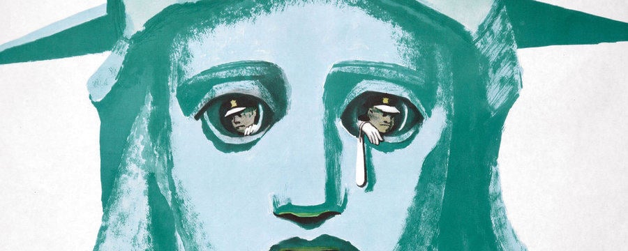
In this film, Maiken speaks to Hayley Cotterill, a senior archivist at Nottingham, who talks about her professional experiences on why maps are produced, altered, and then either preserved in archives or discarded. The three examples she shares with learners move beyond the notion of political territory as seen by states, which Ian focused on in the British Library video. Hayley’s maps are different: they feature land as an economic resource, as part of a culture of orientalism and exploration, and, last but not least, as a site of violent conflict.

Please use the comment box to reflect on the politics of maps that do not represent state territory. In what ways do they resemble the maps discussed by the British Library team? And how do their ideological agendas differ? What are the political implications of mapping ownership of land, or of representing land as a travel destination, or a site of armed conflict?

All images / materials depicted with the permission of University of Nottingham, Manuscripts and Special Collections.

This article is from the free online

Propaganda and Ideology in Everyday Life

Created by
FutureLearn - Learning For Life

Reach your personal and professional goals

Unlock access to hundreds of expert online courses and degrees from top universities and educators to gain accredited qualifications and professional CV-building certificates.

Join over 18 million learners to launch, switch or build upon your career, all at your own pace, across a wide range of topic areas.

Start Learning now