Home / Nature & Environment / Climate Change / Transit-Oriented Development for Climate Mitigation in Urban Centres / Defining TOD

Defining TOD
Explore Transport Orientated Development, an approach to bring people, services and activities together with mobility options.
© RMIT Europe and EIT Urban Mobility
What is TOD?
The Institute of Transportation and Development Policy defines TOD as:
an approach to urban development designed to bring people, services, and activities together, with quality public transport, supported by walking and cycling conditions to facilitate shorter trips, better lifestyles, and more efficient use of city resources.
TOD is a way to offer residents, employees and visitors a car-free or car-lite forms of organising their daily travel tasks, and includes:
- the availability of many activities, or potential travel destinations, at a short walkable distance
- the presence of diverse and high quality non-car travel options, for journeys that remain beyond walking distance, enabling cycling and public transport to capture a greater share of travel at the expense of the car.
TOD marks a shift away from a planning era when long daily journeys by car were accepted and encouraged in the pattern of urban and infrastructure development.
While TOD cannot force transport users to forego car ownership and use, it can embody a range of structural and design elements to ensure that walking, cycling and public transport are as convenient and attractive, or more so, than the private car.
How can such qualities be achieved?
Rambla de Poblenou, Barcelona. ©Jan Scheurer CC BY-NC-SA
Let’s start by what makes walking in an urban setting attractive. As a guiding principle, a good urban walking environment, is made up of the ‘urban DMA’ (Dovey, 2020), which includes:
- density
- mix
- access.
Density
Density refers to the quantity of activities, generally measured by numbers of people, or amount of building space, that are concentrated into an area, with higher densities translating into shorter distances and greater walkable catchments for centralised facilities such as public transport stops, commercial or community centres.
Mix
Mix refers to the diversity of activities or land uses occurring within an area, with a greater diversity allowing for a greater range of daily activities, such as employment, education, health, shopping, recreation to be performed locally within walking range.
Access
Access refers to the quality of the walking environment and asks, is it safe and comfortable, by day or night, in any weather or season? As well does it allow for direct, barrier free journeys that are prioritised over the movement of cars in shared spaces? A better walking environment attracts pedestrian movement, while a poor one repels it.
Urban buzz and intensity
Metrics like the urban DMA are proxies for measuring qualities that citizens often understand intuitively, but are hard to pin down precisely. Tim Stonor (2019) speaks of the ‘urban buzz’, the complex interplay of people and buildings, movement and exchange in cities, a manifestation of density, mix and access perhaps better described as intensity:
Intensity is a word that real people use, and perhaps because it describes the outcomes that people experience rather than the inputs that have gone in to creating them. It is the outcomes that are ultimately more important. (Stonor, 2019, p240)
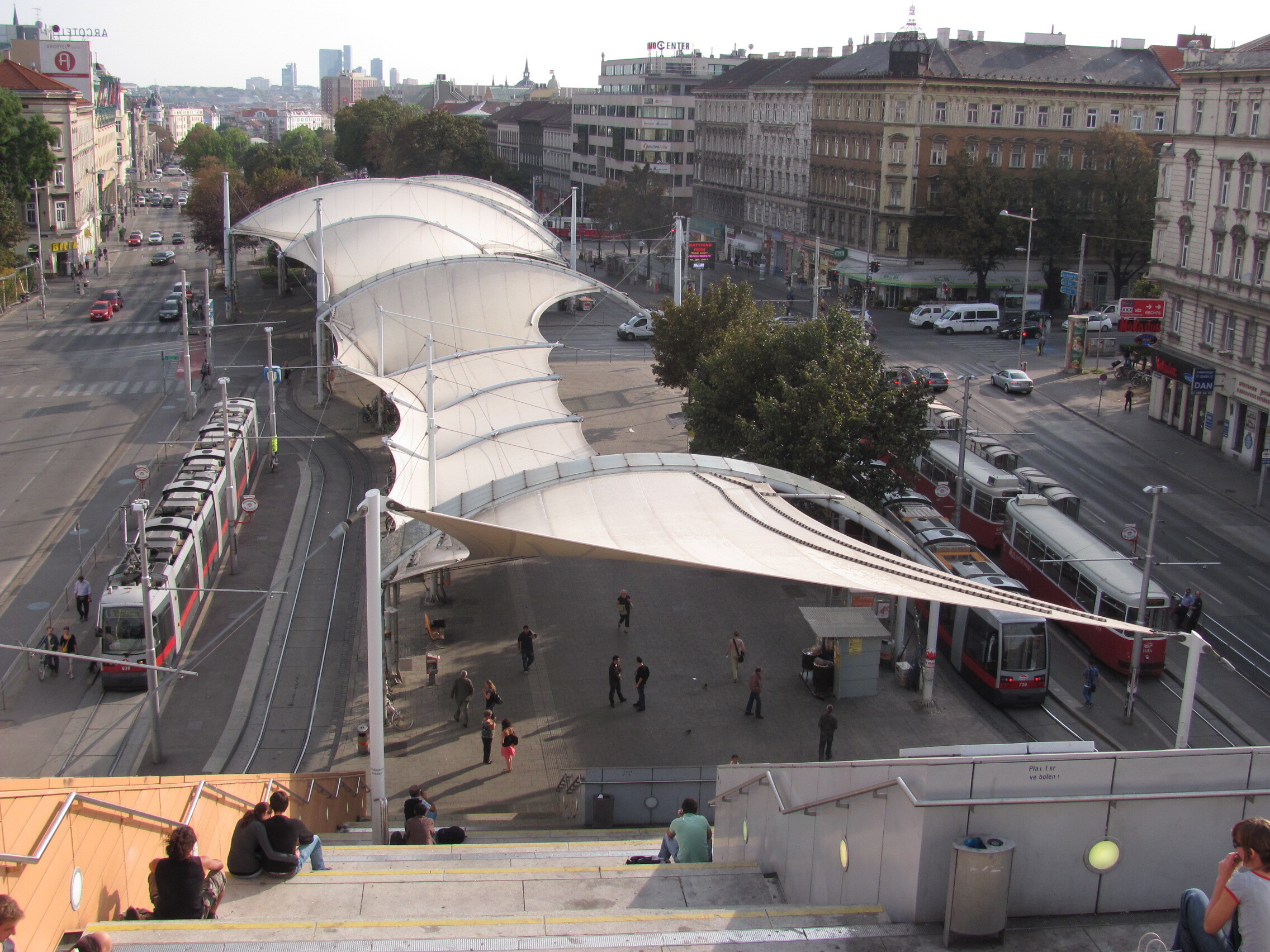
Burggasse-Stadthalle interchange in Vienna. ©Jan Scheurer CC BY-NC-SA
High quality public transport
TOD derives its name from the presence of public transport. To impact the modes of choice residents, workers and visitors make, public transport needs to be high quality. This is in order to offer superior travel options to and from as many destinations as possible and for as many journey purposes as possible. Achieving such a high standard, demands the following:
- service frequency
- service capacity
- speed and overall network design.
Service frequency
Service frequency concerns the number of public transport departures, per hour and determines whether and for how long during the day or week, users can rely on the service to turn up with minimum waiting time, without having to study a timetable. Higher service frequencies obviously correspond to higher operating costs and vehicle demand.
Service capacity
Capacity concerns the mode and vehicle size used on a public transport line. For example, trains or metros usually have a higher passenger capacity per hour than trams or light rail, which in turn have a higher capacity than buses. Deploying a mode whose capacity is too low for the transport task, will result in overcrowding and unreliability and put off existing and potential users.
Conversely, deploying a mode with too generous a capacity can be construed as a poor investment choice. Generally, the higher the desired capacity, the greater the need for capital investment in reserved lanes or tracks, station facilities, tunnels etc. As such, capacity upgrades are invariably a longer-term strategy. Cities experiencing or desiring growth in population or public transport use, or both, will or should embark on a strategic program of public transport capacity expansion.
Speed
Speed concerns the choice of public transport mode, such as trains, trams or buses in their own right-of-way lane, that generally travel significantly faster than those sharing street space with cars or pedestrian. It also describes the geographical alignment of routes. For example, a relatively direct line between origins and destinations versus time consuming detours. Or the seamlessness of transfers as well as traffic priority measures.
Overall network design concerns the way in which users can rely on public transport to travel across a larger metropolitan or regional area with the following questions:
- is it possible to travel in a multitude of directions from each point of origin?
- where it is necessary to make a transfer to do so?
- is the transfer well organised in terms of legibility, walking and waiting times, due to the interchange design, timetable coordination and fare integration?
Successful TOD
For TOD to succeed, it is important to achieve an alignment between land use, walkability and public transport quality to generate the specific spatial context that Jarrett Walker (2012) refers to as ‘good transit geography,’ and spread it over as large a portion of the settlement area as possible:
An efficient transit line and, hence, one that will support good service, connects multiple points; but is also reasonably straight so that it’s perceived as a direct route between any two points on the line. Good transit geography is any geography in which high demand transit destinations are on a direct and operable path between other high demand transit destinations (Walker, 2012).
Further resources
If you would like to explore some of the concepts we have covered in more detail, the following resources are optional.
What is walkability? The urban DMA
Measuring intensity – Describing and analysing the ‘urban buzz’
© RMIT Europe and EIT Urban Mobility
This article is from the online course:
Transit-Oriented Development for Climate Mitigation in Urban Centres

Created by

This article is from the free online
Transit-Oriented Development for Climate Mitigation in Urban Centres
Reach your personal and professional goals
Unlock access to hundreds of expert online courses and degrees from top universities and educators to gain accredited qualifications and professional CV-building certificates.
Join over 18 million learners to launch, switch or build upon your career, all at your own pace, across a wide range of topic areas.


