
Allen Coral Atlas: The First High-Resolution Map of the World’s Coral Reefs

Emerging technology may be a gamechanger for coral reef conservation. Using satellite imagery and machine learning, the new Allen Coral Atlas will map all shallow-water coral reefs throughout the globe. This innovation comes on the heels of Atlas’s launch of the world’s first satellite-based coral bleaching monitoring system, which identifies bleaching events in real time. Our Shared Seas checked in with the Atlas team to learn more about how these tools can help protect and restore reefs worldwide.
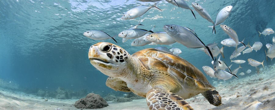
Covering less than 0.1 percent of the ocean floor, coral reefs are home to more than 25 percent of all marine species. Roughly 850 million people depend on reefs for food security and livelihoods, and 30 million small-scale fishing jobs are tied to coral reefs. Despite the ecological and economic importance of coral reefs, a lack of information about the location and extent—much less real-time condition—of coral reefs globally has made it difficult to monitor reef conditions at scale and target conservation activities to safeguard reefs.
What is the Allen Coral Atlas and how did the project start?
The Allen Coral Atlas was formed when a group of remote sensing, conservation, and coral ecology experts came together to bring together much-needed advancements in satellite technology and coral reef science. Since its founding, the Allen Coral Atlas has developed cutting-edge technology to automate the mapping and monitoring of coral reef habitats based on high-resolution satellite imagery and machine learning. The result is a game-changing scientific tool to help reef science and conservation tackle this data-availability obstacle.
Atlas is an international collaborative partnership involving Planet Labs, The Arizona State University, The University of Queensland’s Remote Sensing Research Centre, The National Geographic Society and Vulcan Inc., with each partner playing a critical role in the development of this cutting-edge scientific tool for reef science.
As a mapping tool, what are the challenges that the Atlas seeks to address? There are many challenges that face coral reef managers, scientists, and conservationists today. One major obstacle is the lack of data and accessible tools to determine the exact location of coral habitats. Mapping underwater with surveys and field-based methods is costly, time-intensive, and requires accessing very remote areas in risky conditions. These approaches for coral reef mapping are sometimes necessary and many highly valuable local and regional maps have been made through direct observation. However, it is not feasible to visit every coral reef in the world and produce such maps on a global scale. Coral researchers and managers also need accessible visual references in their work to educate government officials and policymakers on the plight of coral habitats. For this reason, data visualization is also a top priority.
What is the current status of the Allen Coral Atlas and what is on the horizon for your team?
The partnership has been working diligently since 2018 to first develop and test our methods, and then produce globally consistent ocean map layers region by region. As of May 2021, we have mapped approximately 80 percent of shallow tropical coral reefs. This includes Eastern Africa, West Indian Ocean, the majority of Southern and Southeastern Asia, Northern Caribbean and Bahamas, Great Barrier Reef and Torres Strait, and several other regions.
The Atlas system is instrumental to spatial planning, protected area management, reef restoration, coastal protection, and disaster risk reduction. We are already seeing coral reef managers and the conservation community apply the Atlas to critical coral reef conservation projects around the world. Never before has the global coral conservation community had consistent, comparable, up-to-date access to the global coral data it needs to protect these critical resources. The possibilities for applications and conservation impact are vast.
Our team is also interested in broadening the spatial scope of the Atlas. In the future, we hope to bring our mapping efforts from the shoreline to mapping mangroves and inland areas. This opens opportunities to address land-sea interactions affecting reefs, people, climate, and biodiversity. We also expect to move our depth limitation to deeper marine areas, further expanding the range of areas that can be mapped on the Atlas.
One of the unique features of the tool includes detecting and analyzing coral bleaching in real-time. Can you provide context on how this will enable coral reef managers to react to bleaching events with greater speed and accuracy? The system tracks changes in the color of reefs (known as spectral signature), which is associated with coral bleaching events caused by marine heatwaves. The tool operates globally in bi-weekly increments. With this information, coral managers can actively respond with targeted conservation efforts to limit additional impacts to the most vulnerable areas, as well as trigger data collection protocols focused on bleaching assessment.
Bleaching event response strategies are advancing around the world. Nations with coral reefs are taking more care to educate visitors and locals alike on how coral bleaching affects the ecosystem, and the importance of limiting other stressors on corals, especially when bleaching events are occurring. Making bleaching detection faster, more accurate, and highly visible will help demonstrate the reality of the staggering and widespread damage of one of the world’s most vulnerable ecosystems. As a real-time tool, the Atlas can bring bleaching events—and what to do about them—front and center for governments and the public alike.
Who are the intended users of the Allen Coral Atlas and what do you hope they will do with the tool? Atlas users span a wide range of expertise and roles, from marine spatial planners seeking regionally comparable data for large-scale assessment and spatial analysis to governments and policy makers who need better data to make informed decisions about marine protection and planning. Applications of the tool can be used in a broad variety of contexts, including coral restoration efforts, ridge to reef research, strategic conservation planning, community engagement, and marine policy. Its user-friendly platform also makes the Atlas an educational tool to familiarize learners of all ages with geospatial data and visualization.
Managers of marine protected areas can use both the bleaching and turbidity monitoring systems to track these conditions over time. Bleaching detection can help inform site closures or other time-sensitive management decisions when it comes to limiting stressors on corals experiencing bleaching.
A key challenge for coral reef managers and practitioners is determining when and where to implement restoration activities. How will the Atlas help stakeholders maximize investment and conservation outcomes? No single map or geospatial tool is a silver bullet for all marine conservation planning challenges. For restoration projects, it is difficult to use machine learning and satellite imagery to replace the work of underwater teams that are collecting detailed benthic habitat data. Depending on the region, many nations also have excellent maps available at a finer level of detail than the Atlas, which is more suited for restoration planning.
However, for areas that lack detailed maps, or larger scale restoration planning, the Atlas can help identify habitats that may warrant a visit from a survey team. In this way, a tool derived from remote sensing such as the Atlas can allow a restoration project team to prioritize where to put finite funds toward site exploration.
Have you already seen applications of Atlas in the field? If so, what did this look like? We are already seeing the Atlas used in projects ranging from “Ridge to Reef” research in Vanuatu, marine spatial planning and prioritization modeling in Western Indian Ocean and Eastern Africa by the Geological Survey of Sweden, and marine protected area planning in the remote Lakshadweep Island group in the Arabian Sea. Satellite imagery behind the Atlas was even used in a post-disaster assessment following the devastating tropical cyclone Harold in the Southwestern Pacific.
The International Union for Conservation of Nature (IUCN) is currently using the Atlas for marine spatial planning in Samoa. The benthic layer of the Atlas was used to identify and classify Special, Unique Marine Areas (or SUMAs) in Samoa in conjunction with IUCN’s marine spatial planning. One problem they encountered during this planning process was integrating knowledge from local communities into the maps that IUCN uses for their analysis. The IUCN team in Samoa uses the visualized Atlas data layers to provide stakeholders with a point of reference and a basis from which to gather input from local communities. In this way, Atlas can serve as a tool to bridge the gap between science and stakeholders.
The Atlas can also enable managers who may not have the time or resources to learn GIS software to view and engage with geospatial data. Simple analyses and layer visualization features allow users to get started without an advanced and complicated platform.
Life Below Water: Conservation, Current Issues, Possible Solutions

Life Below Water: Conservation, Current Issues, Possible Solutions
Reach your personal and professional goals
Unlock access to hundreds of expert online courses and degrees from top universities and educators to gain accredited qualifications and professional CV-building certificates.
Join over 18 million learners to launch, switch or build upon your career, all at your own pace, across a wide range of topic areas.


